The Last Millenium: New version: 1.0.1 released (2/13/2022) (dead mod)
-
Similar Content
-
historical Cruel ages II english version|10.3k thanks to everyone,the 0.0.3 will release next week 1 2
By hitsmods,
- 25 replies
- 10,378 views
-
- 3 replies
- 2,582 views
-
- 0 replies
- 620 views
-
MAGNA HISTORIA - MAKING THE LARGEST AOH2/3 MAPS (Inspired by Mappa Mundi) - Work in Progress - 15K VIEWS! 1 2 3 4 6
By PeteFromPat,
- 138 replies
- 15,571 views
-
- 6 replies
- 781 views
-
-
Popular Now
-
Question: Will there be any surprise for 100,000 subscribers on Youtube?
By Rodak Polak, in Questions
- Has best answer
- 2 votes
- 11 answers
-
- 13 replies
- 225 views
-
- 18 replies
- 1,704 views
-
-
Our picks
-
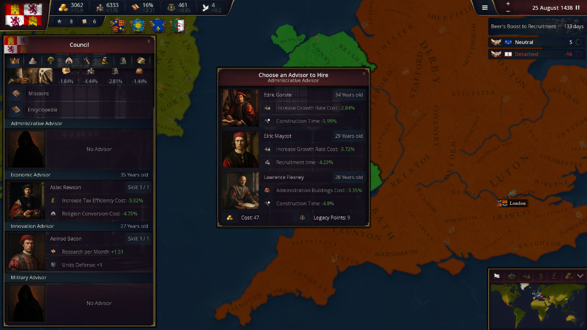
AoH3 – Help with translation of the Game
Łukasz Jakowski posted a topic in Translations,
Hi, I need your help translating the Age of History 3 to your native language.
Your translation into your native language would be very helpful! ❤️
In the attachment is a file with new texts in the game to be translated.
How to make translation:
In the file there is list of texts in the game
The Left side is the key, do not change it!
The right side of each line after = is the translation to your language
Example:
ChooseAnAdvisorToHire = Choose an Advisor to Hire
ChooseAnAdvisorToHire is the key, don't change it
Correctly made translation:
ChooseAnAdvisorToHire = Your translated text
ClickToHireAnAdvisor = Your translated text
ClickToFireAnAdvisor = Your translated text
etc.
ShiftClickToInvestXTimes = Shift + Click to invest {0} times
In the place of {0} will be placed number or text
PerformTheActionXTimes = Perform the action {0,choice,0#{0} times|1#{0} time|1<{0,number,integer} times}
For now the game is translated to: Only English language!
translation.txt-
-
- 648 replies
Picked By
Łukasz Jakowski, -
-
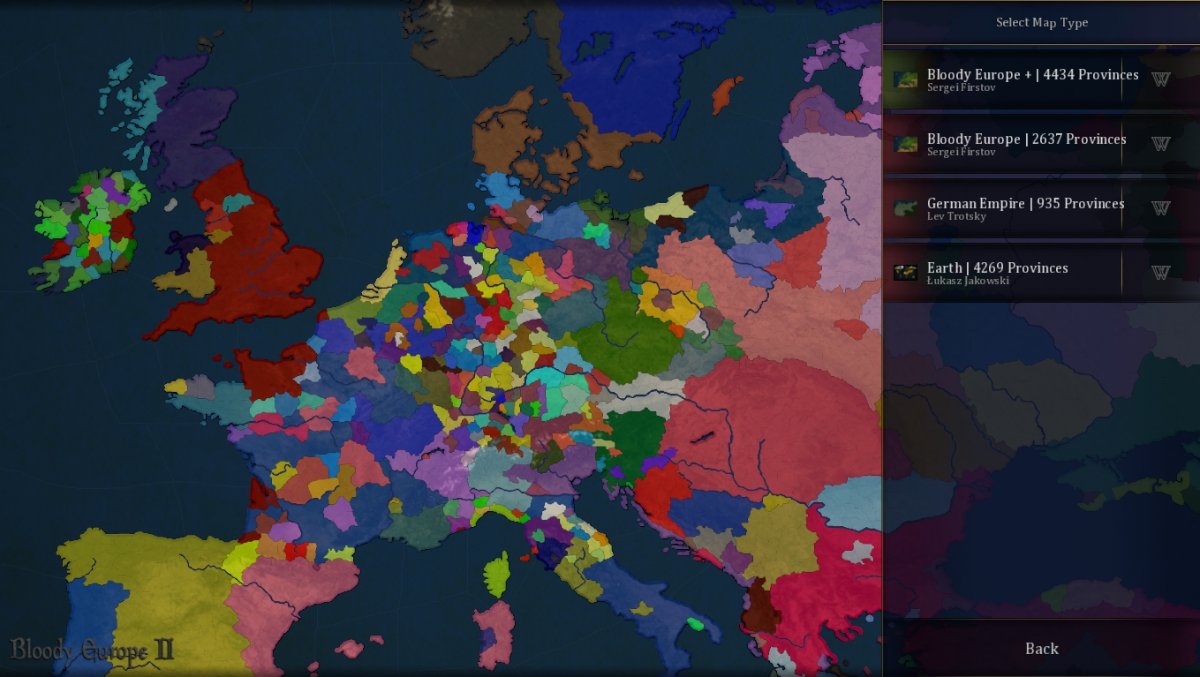
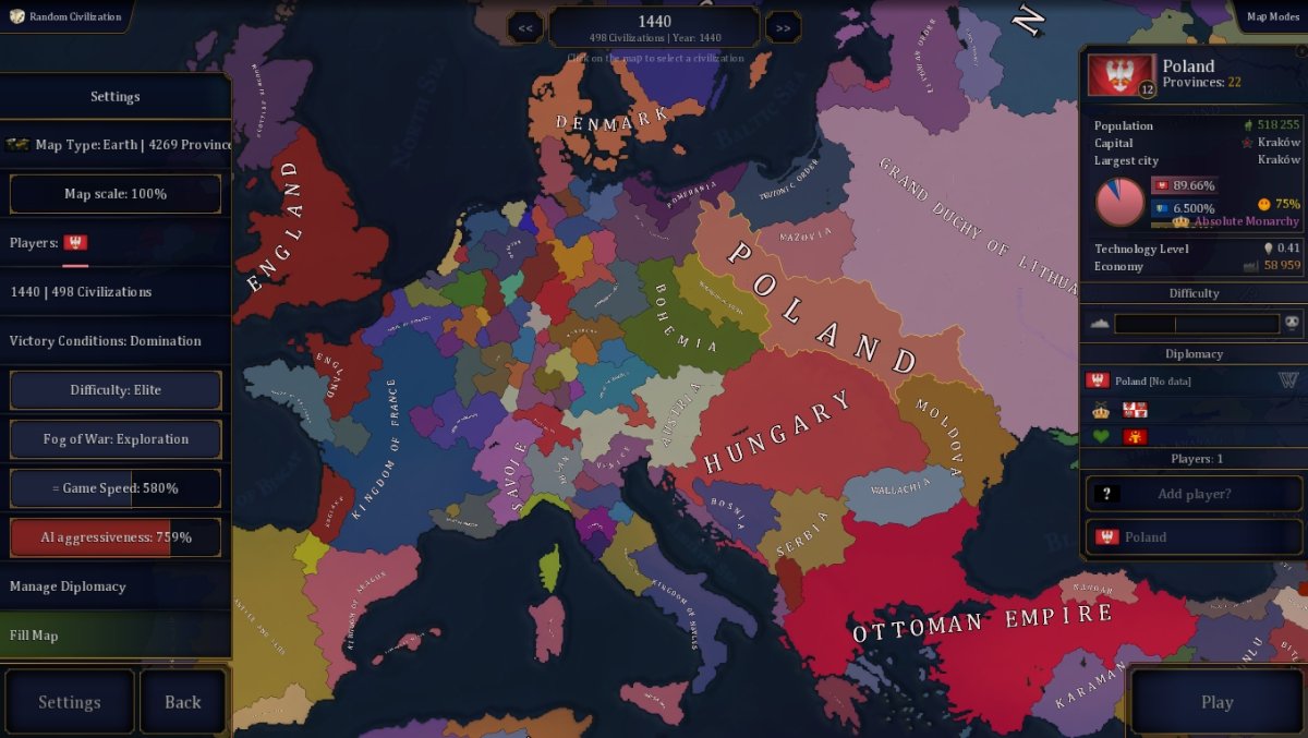
Bloody Europe II | New update
Trans-Amur posted a topic in Mods,
Bloody Europe II - it's a mod with a huge map of Europe.
In these mod is:
-Giant map of Europe (4434 provinces) + big map of Europe (2637 provinces) + large map of German Empire (937 provinces)
-Large count of scenarios from ancient times to alternative future
-New fonts and music
-Plenty of new civilizations, form civs and union
-You will see changes in the game code that will change the game significantly-
-
- 1,749 replies
Picked By
Łukasz Jakowski, -
-
Events - Common events for every civilization in the game
Łukasz Jakowski posted a topic in Ideas for the Age of History 3,
Hi,
in this topic, I am interested in your ideas for events that can happen for every Civilization in the game.
I'm also interested in Missions for every Civilization.
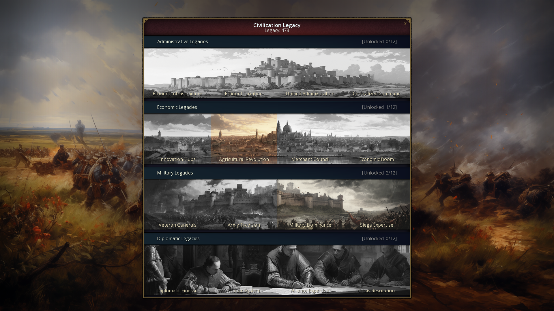
Here is some example, have more than 10k army, have more than 5000 gold, build 10 buildings, recruit an Advisor, increase tax efficiency 20 times, be largest producer of some resource in the world, unlock 5 Civilization legacies etc.-
-
- 169 replies
Picked By
Łukasz Jakowski, -
-
First preview of the Alpha version of Age of History 3
Łukasz Jakowski posted a topic in Informations,
First preview of the Alpha version of Age of History 3, YouTube.
Release date: When it's ready 😛 Subscribe for more!
-
-
- 183 replies
Picked By
Łukasz Jakowski, -
-
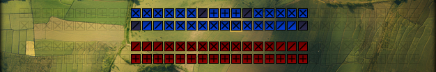
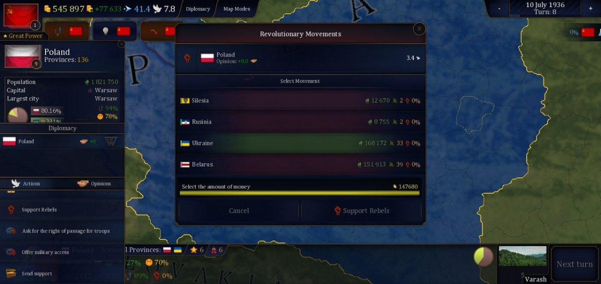
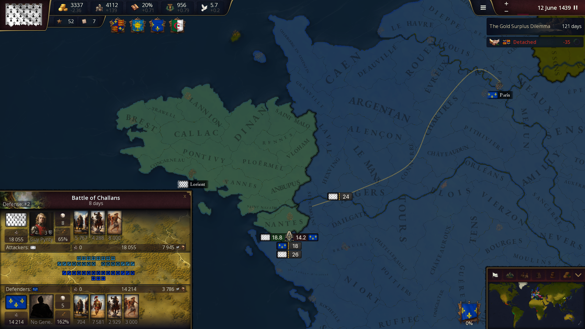
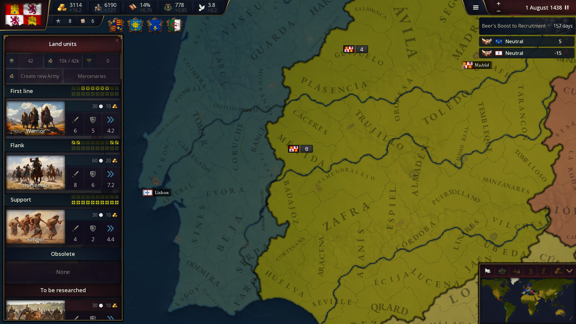
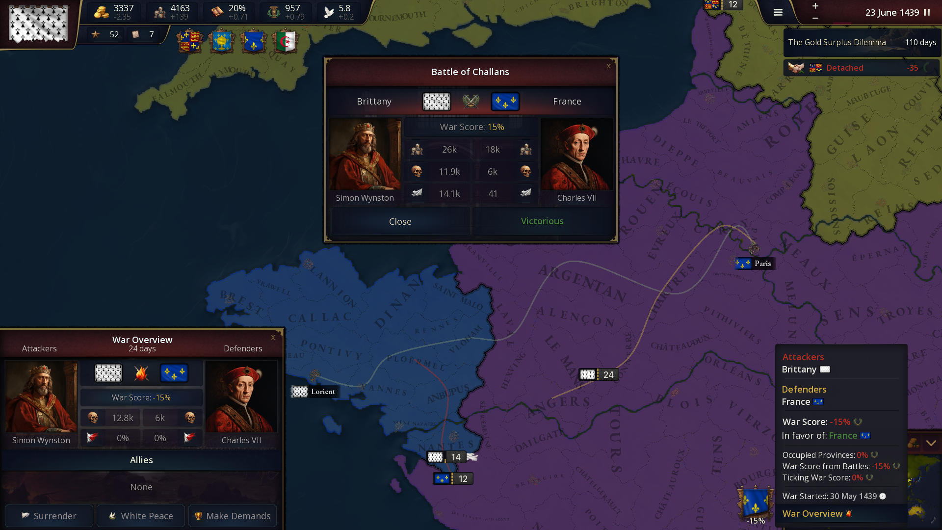
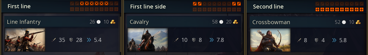
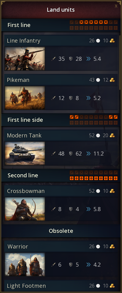
Land units - Ideas AoH3
Łukasz Jakowski posted a topic in Ideas for the Age of History 3,
AoH3 will have different types of land units.
In this topic we will write ideas for new land units.
So the AoH 3 will have new battle system.
Representation of the battlefield in the game.
Land units will be grouped into 3 types. Each unit will have a different recruitment cost, attack, defense, movement speed and upkeep.
Groups determine the placement of units on the battlefield.
Each unit can be unlocked by researching technology and then upgraded.
Here is the current list of units with upgrades:
First line:
Warrior -> Light Footmen -> Heavy Infantry -> Infantry -> Line Infantry -> Modern Infantry
Hoplites -> Spearmen -> Pikeman -> Elite Pikeman -> Musketeer -> Riflemen -> Mechanized Infantry -> Modern Mechanized Infantry
First line side:
Horseman -> Elite Horseman -> Cavalry -> Tank -> Modern Tank
Second line:
Archer -> Bowmen -> Crossbowman -> Elite Crossbowman
Canon -> Field Cannon -> Artillery -> Modern Artillery
Early Airplane -> Airplane -> Modern Airplane
This is a very early version, so maybe something should be changed?
Or maybe an idea for a new type of unit with upgrades? I'm waiting for your suggestions.
-
-
- 205 replies
Picked By
Łukasz Jakowski, -


.thumb.png.b4884772055b0d92a22e947c0e3dd186.png)